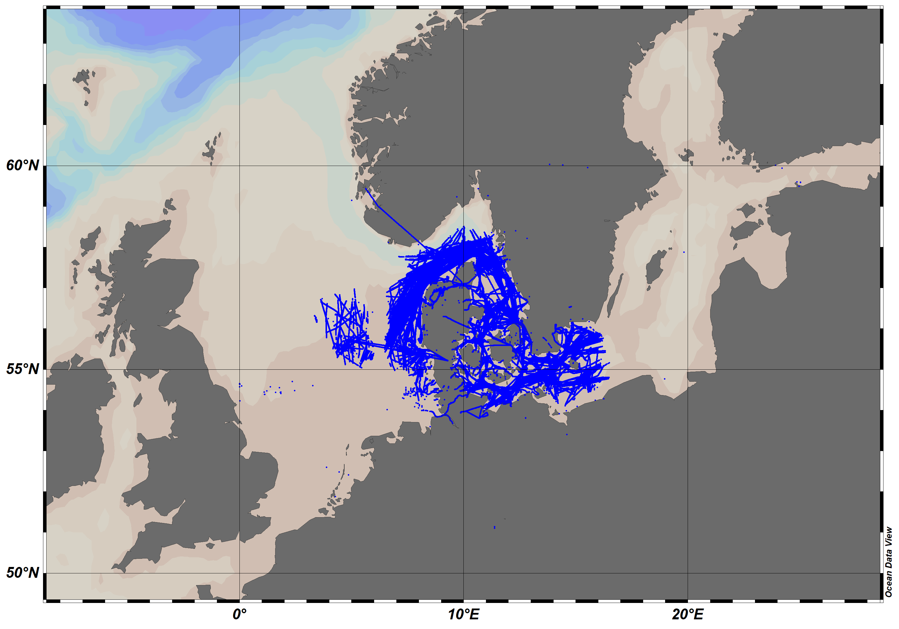
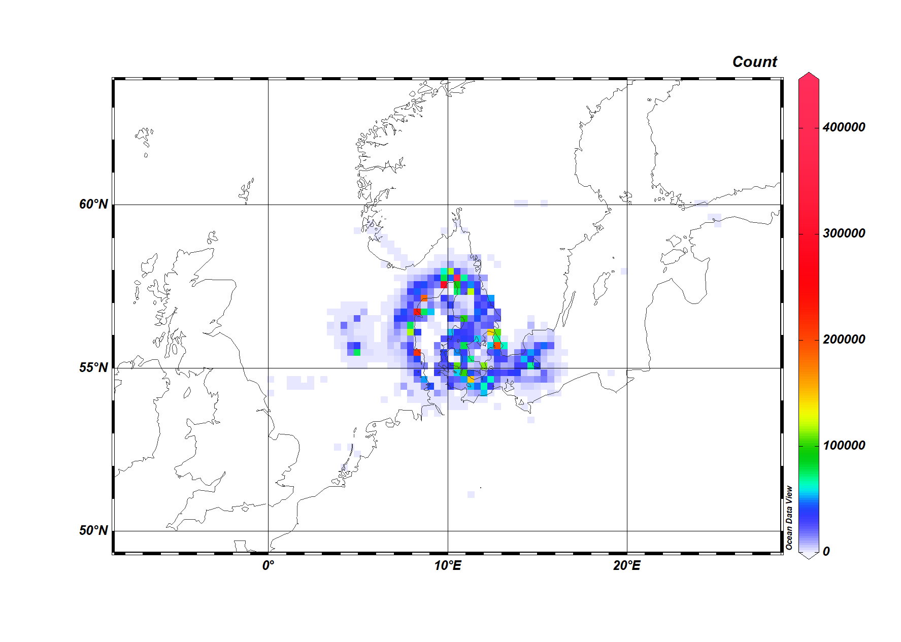
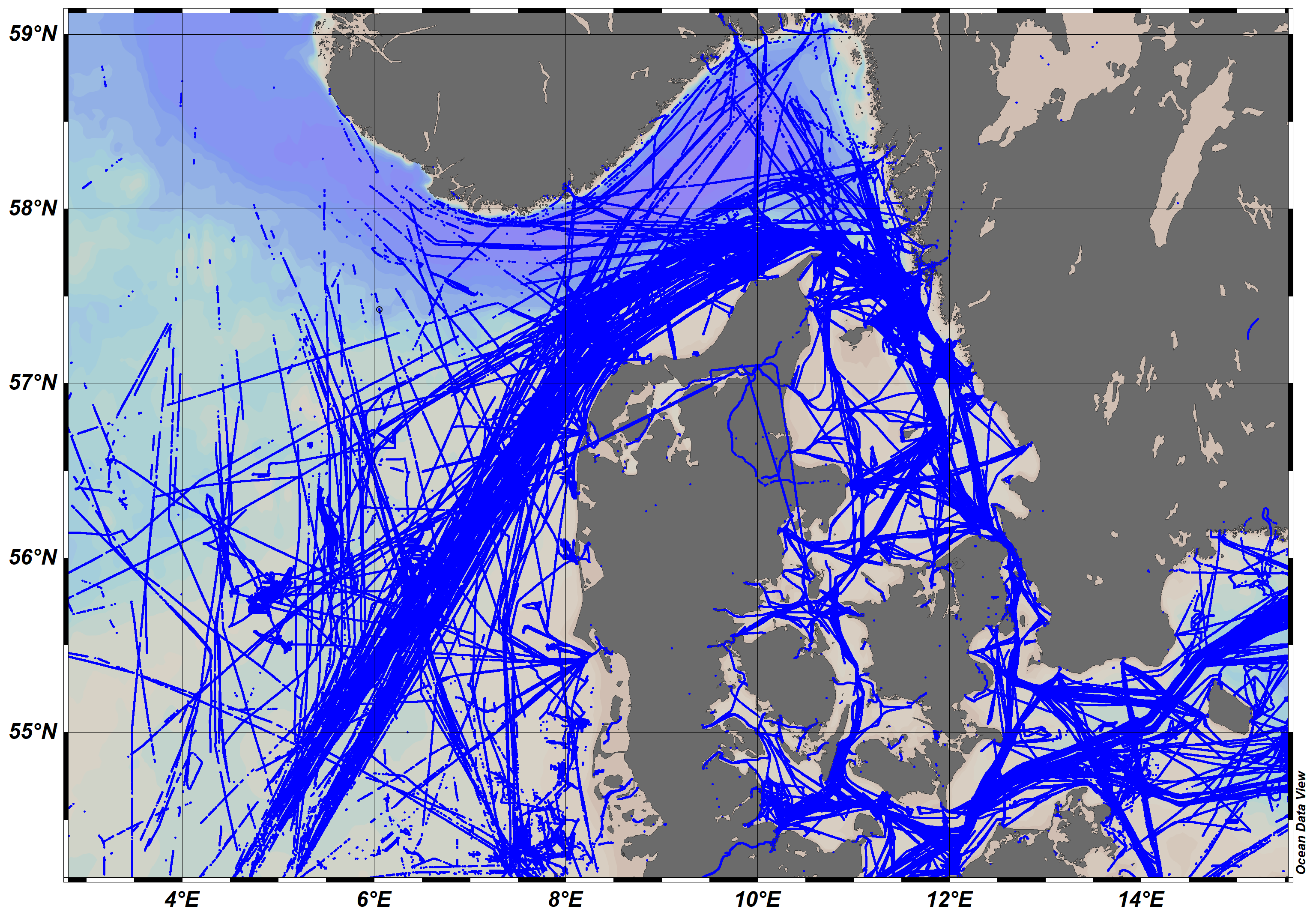
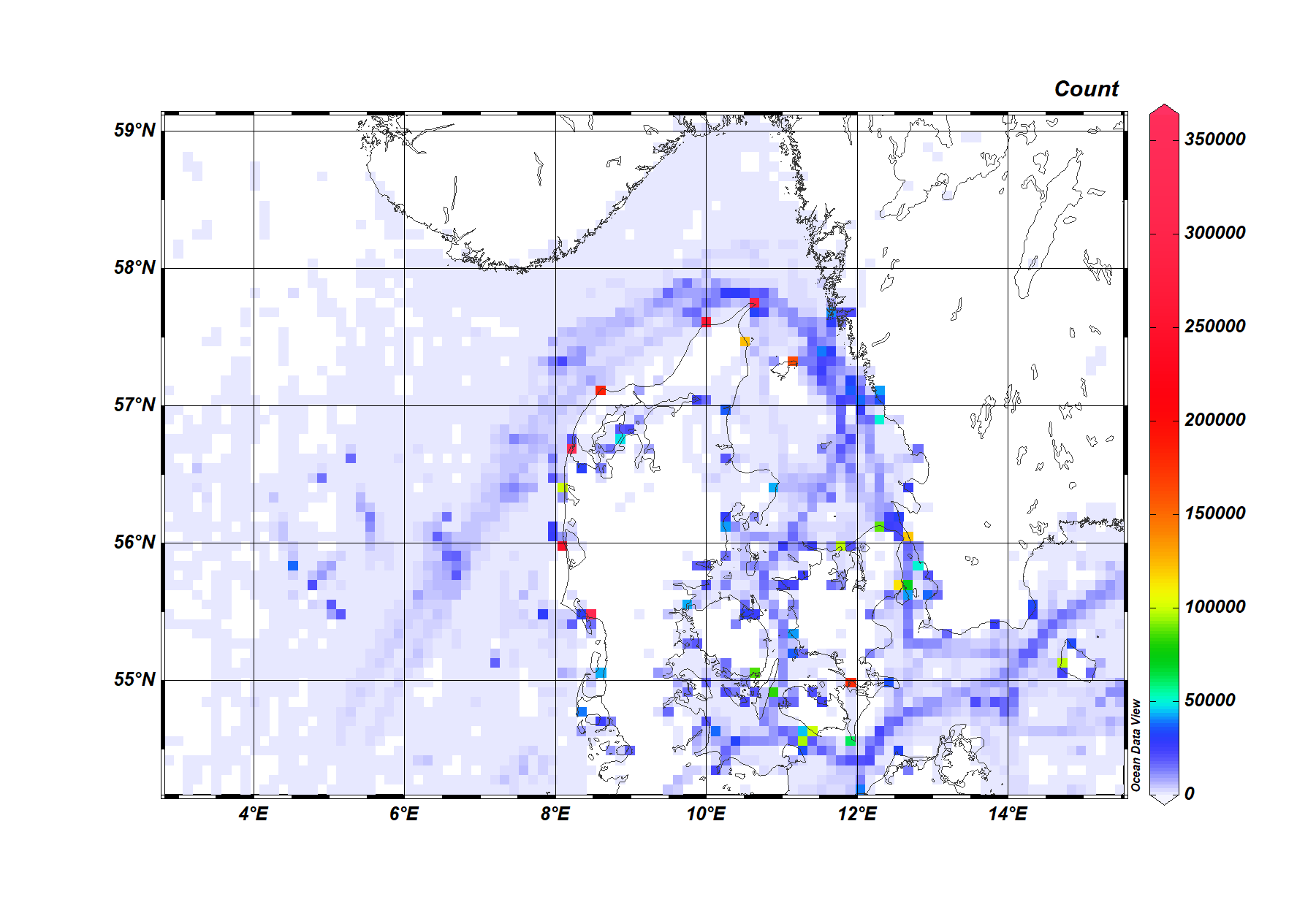
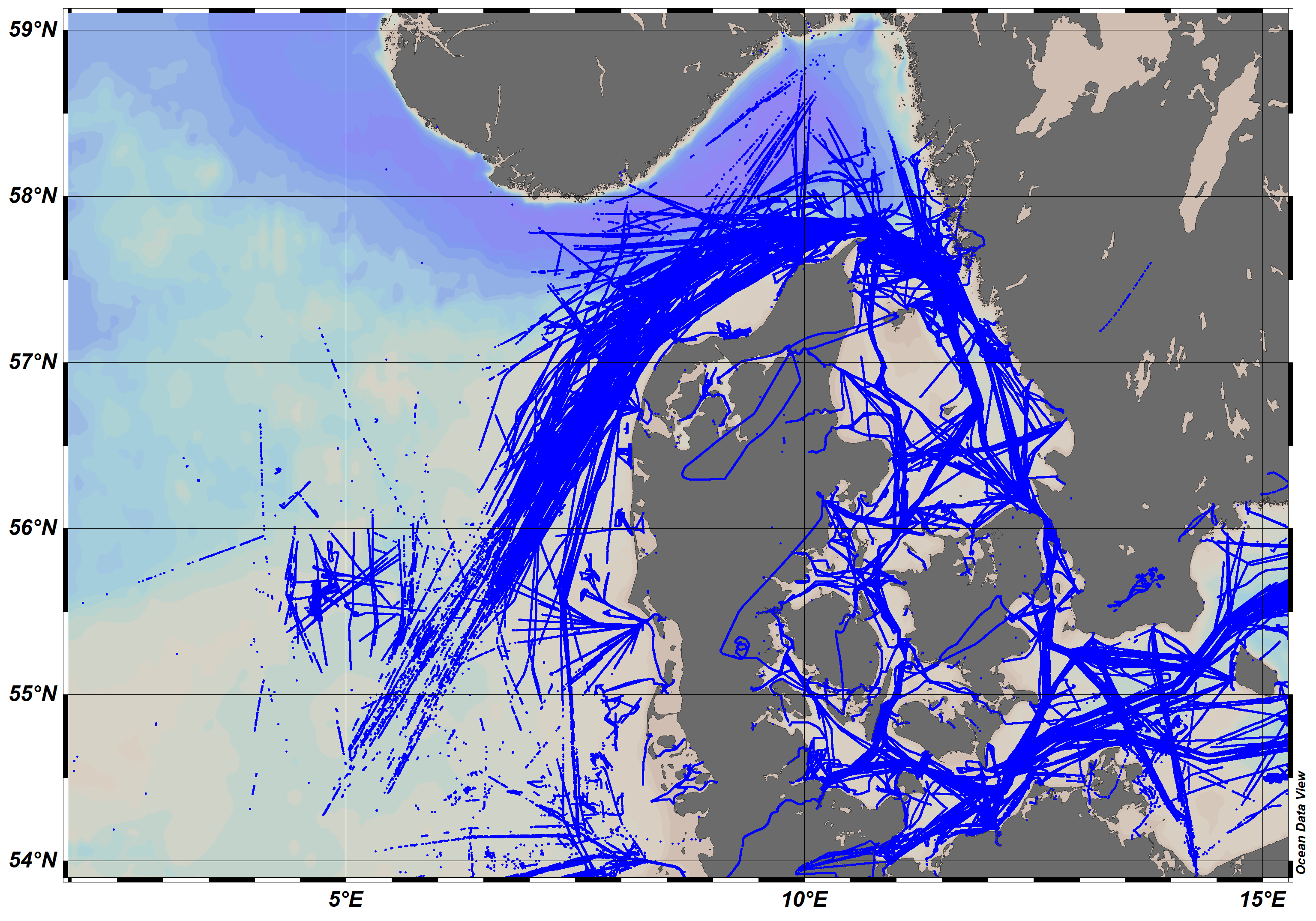
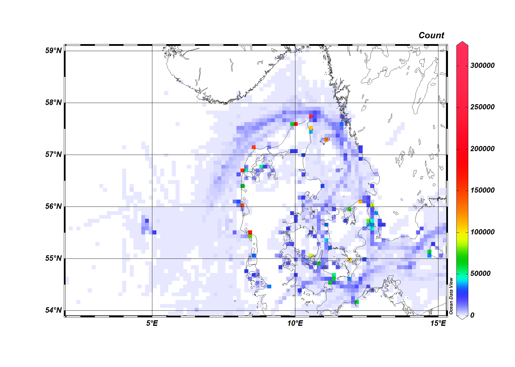
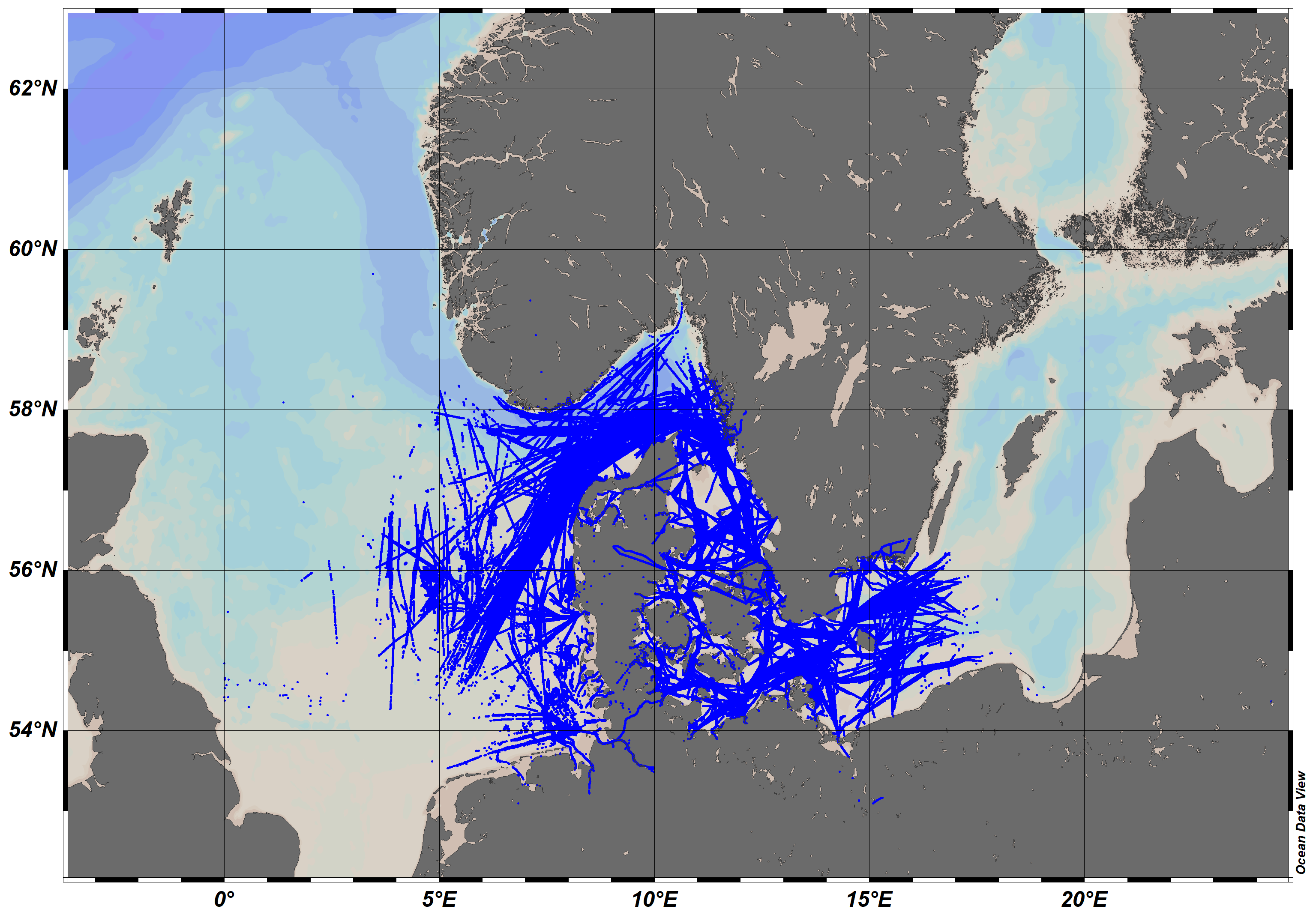
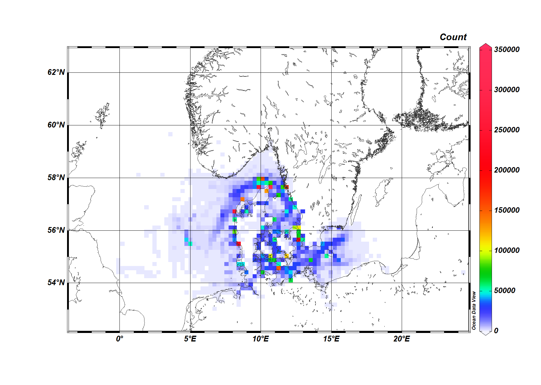
Danish Maritime Authority (DMA) AIS data using Ocean Data View
https://dma.dk/safety-at-sea/navigational-information/download-data
!_README_information_CSV_files.rtf
| 1. | Timestamp | Timestamp from the AIS basestation, format: 31/12/2015 23:59:59 |
| 2. | Type of mobile | Describes what type of target this message is received from (class A AIS Vessel, Class B AIS vessel, etc) |
| 3. | MMSI | MMSI number of vessel |
| 4. | Latitude | Latitude of message report (e.g. 57,8794) |
| 5. | Longitude | Longitude of message report (e.g. 17,9125) |
| 6. | Navigational status | Navigational status from AIS message if available, e.g.: 'Engaged in fishing', 'Under way using engine', mv. |
| 7. | ROT | Rot of turn from AIS message if available |
| 8. | SOG | Speed over ground from AIS message if available |
| 9. | COG | Course over ground from AIS message if available |
| 10. | Heading | Heading from AIS message if available |
| 11. | IMO | IMO number of the vessel |
| 12. | Callsign | Callsign of the vessel |
| 13. | Name | Name of the vessel |
| 14. | Ship type | Describes the AIS ship type of this vessel |
| 15. | Cargo type | Type of cargo from the AIS message |
| 16. | Width | Width of the vessel |
| 17. | Length | Lenght of the vessel |
| 18. | Type of position fixing device | Type of positional fixing device from the AIS message |
| 19. | Draught | Draugth field from AIS message |
| 20. | Destination | Destination from AIS message |
| 21. | ETA | Estimated Time of Arrival, if available |
| 22. | Data source type | Data source type, e.g. AIS |
| 23. | Size A | Length from GPS to the bow |
| 24. | Size B | Length from GPS to the stern |
| 25. | Size C | Length from GPS to starboard side |
| 26. | Size D | Length from GPS to port side |
2.6G    aisdk-2023-02-15.csv
1.6G    aisdk-2023-02-22.csv
1.8G    aisdk-2023-03-01.csv
1.5G    aisdk-2023-03-08.csv
head aisdk-2023-02-15.csv
# Timestamp,Type of mobile,MMSI,Latitude,Longitude,Navigational status,ROT,SOG,COG,Heading,IMO,Callsign,Name,Ship type,Cargo type,Width,Length,Type of position fixing device,Draught,Destination,ETA,Data source type,A,B,C,D
15/02/2023 00:00:00,Class A,219063000,57.1152,8.33121,Under way using engine,0.0,6.4,216.9,217,Unknown,,,Undefined,,,,Undefined,,,,AIS,,,,
15/02/2023 00:00:00,Class A,220228000,55.4732,8.42364,Engaged in fishing,0.0,0.0,136.7,332,Unknown,,,Undefined,,,,Undefined,,,,AIS,,,,
15/02/2023 00:00:00,Base Station,2190064,56.7166,11.5191,Unknown value,,,,,Unknown,,,Undefined,,,,GPS,,,,AIS,,,,
15/02/2023 00:00:00,Class A,220228000,55.4732,8.42364,Engaged in fishing,0.0,0.0,136.7,332,Unknown,,,Undefined,,,,Undefined,,,,AIS,,,,
15/02/2023 00:00:00,Class A,220304000,56.7157,11.5125,Engaged in fishing,0.0,0.0,271.8,289,Unknown,,,Undefined,,,,Undefined,,,,AIS,,,,
15/02/2023 00:00:00,Class A,355378000,55.4983,5.41641,Under way using engine,0.0,11.9,17.6,15,Unknown,,,Undefined,,,,Undefined,,,,AIS,,,,
15/02/2023 00:00:00,Class A,220304000,56.7157,11.5125,Engaged in fishing,0.0,0.0,271.8,289,Unknown,,,Undefined,,,,Undefined,,,,AIS,,,,
15/02/2023 00:00:00,Base Station,2194006,55.5389,5.0334,Unknown value,,,,,Unknown,,,Undefined,,,,Surveyed,,,,AIS,,,,
15/02/2023 00:00:00,Class A,219002857,55.6791,12.5935,Under way using engine,0.0,0.0,270.3,297,Unknown,,,Undefined,,,,Undefined,,,,AIS,,,,
aisdk-2023-02-15
aisdk-2023-02-22
aisdk-2023-03-01
aisdk-2023-03-08